Click any place
to see on map.
Local Points
The base area of Mt Tsurugi is the small settlement of Minokoshi
which has a few guesthouses and restaurants (the hours and days for most places are sporatic, but Minshuku Matsuura
is reliably open daily). Here you can also find the Enpukuji Temple
and the Tsurugi Shrine,
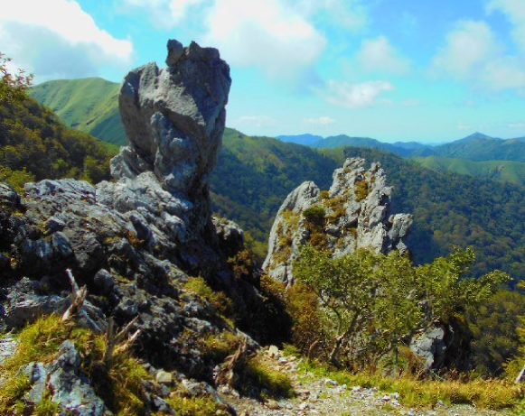
which is next to the Tsurugi Hiking Trailhead.
The Tsurugisan Bus Stop
is located next to a set of public toilets at the edge of the main parking area. There is a very small but free nature museum
upstairs in the center of the main parking area.
At the far end of the Minokoshi parking area is the Tsurugi Chairlift
which goes about halfway up the mountain to Nishi-jima Lift Station
and is near to Nishi-jima Campground.
Downstairs in the chairlift building in Minokoshi is the Tsurugisan Kanko Center
which has hiking info, free maps, and a cafe.
On top of the mountain is the Tsurugisan Chojo Hutte & Restaurant
with a great view to the east and about a 5 minute walk to the top of Mt Tsurugi.
And about 6 or 7 minutes north of Minokoshi on Rt 438 by vehicle (40-45 minutes by walking) is La Foret Tsurugi Hotel
which is also the trailhead point for Mt Maruzasa
and Mt Tonomaru
Access by Car
** During heavy rain the roads up to here often close **
By car,
Minokoshi
is at the end of
Rt 439
and is the deepest point in the Iya Valley. Its about a 15 minute drive beyond the
Oku-Iya Double Vine Bridges
or about 75 minutes from the
Kazurabashi Area
down in Nishi-Iya.
For most of the drive through Oku-Iya the road is one-laned and curvy, and in winter the road may be too snowy to drive beyond
Nagoro
(Scarecrow Village). After Nagoro its pretty remote and except for the Double Vine Bridges, there is nothing but forest the rest of the way out to Minokoshi.
It is also possible to reach Minokoshi along
Rt 438
to/from the north through Tsurugi Town, or to/from the east through Koyadaira and Kamiyama. For complete driving info for reaching here from those places, check the
Transport Page
under
"Transport To & From Miyoshi"
. Once there, open up
"Tokushima by Car"
and see the section in there called
"Oku-Iya Mountain Roads"
.
By bus, it can be a little tricky getting all the way the
Tsurugisan Bus Stop
in Minokoshi. The main Shikoku Kotsu Buses which originate in Ikeda and go via Oboke and Nishi-Iya do not travel this far, with their last stop being at
Kubo
in Oku-Iya (about 40 minutes by vehicle from Minokoshi). However, the
Local Miyoshi Municipal Bus of Oku-Iya
does come out this far twice a day, but this bus only offers service to Minokoshi on limited days, which is only from mid April to late November on every Saturday, Sunday, and Holiday, as well as every day during certain vacation periods (these are usually from the 4th Monday in April to the first Friday in May, from the 3rd Monday in July to August 31, and from October 1 to November 3).
It is also possible to take other seasonal buses for Minokoshi to/from the north through Tsurugi Town (connecting to
JR Sadamitsu Station
) or
to/from the east through Koyadaira and Mima City (connecting to
JR Anabuki Station
- the JR Anabuki to Mt Tsurugi bus is suspended for 2022 and it is unknown if it will restart in the future).
These buses operate less often than the local seasonal bus through Iya, but if you time it right it does make for a nice connecting loop.
See the
Seasonal Buses
section on the
Transport Page
for complete bus info about reaching Minokoshi from those places.
Also, if looking for a
daily bus option,
it is possible to hike in/out via
Kawakami Bus Stop
where buses go everyday all year to
JR Anabuki Station. It is a long hike, so not for everyone. Details for this route are given on the Full Screen Map under
Mt Ichi-no-mori Trail.
For detailed descriptions of the hiking trails going up Mt Tsurugi from Minokoshi, find them by opening the Full Screen Map.
One can also walk to/from Mt Tsurugi from many other mountains. A good full day (and possibly overnight) hike would be via the Maruishi Trail
to/from Maruishi Trailhead
which is at the location of the Oku-Iya Niju Kazurabashi
(Double Vine Bridges). Details for the Maruishi Trail are given on the Full Screen Map
It is also possible to hike in/out via Kawakami Bus Stop
where buses connect everyday all year to JR Anabuki Station. It is a long hike up to Mt Ichi-no-mori
(but way easier going down), so it is not for everyone. Details are given on the Full Screen Map under Mt Ichi-no-mori Trail.
And if you got the time, skill, and energy, hiking in/out along the South Ridge on a multi-day hike via Mt Miune
or Mt Tenguzuka
is an awesome experience. Just be sure to have proper gear and ability!